Greenseams Milwaukee, Wisconsin
Challenge
The Milwaukee region has steadily grown since the year 2000, with an annual average growth rate of 3.68 percent, to a population slightly above 1.5 million people (US Census 2014). As the region continues to grow, so do its impervious surfaces. With more housing, pavement and concrete, the absorbent wetlands diminish and water quality decreases. Major storms are causing significant flooding events and overflowing sewer systems. Due to the increased storm events, the region has continuously faced threats of flash flooding, damaged roads, closed roads, blocked roads, mudslides, shoulder and culvert washouts, flooded basements, damaged buildings and vehicles, and oil and gas leaks.
Project Details
- Location: Metropolitan Milwaukee, WI
- Population: 1,555,908
- Strategies: Open Space Acquisition, Floodplain Restorations, Floodwater Detention Areas, Regulation
Overview/History
At the time of early European settlement, more than 10 million acres of wetland were found in what is now considered Wisconsin. However, in the past 150 years, the state has lost nearly 50% of its wetlands, and a large portion that remain (especially in the populated southern half of the state) are considerably degraded, most notably in the Milwaukee Basin (WWA 2002). Until the early 1970s, federal policy promoted draining wetlands, and many federal and state programs spent large sums to bring vast areas of wetland under cultivation. This loss of wetland acres has affected the overall water quality of the region and wildlife habitat, and it has increased the potential of severe flood events.
Since the 1980s, when the value of wetlands was eventually recognized, the rate of wetland loss from development slowed, but losses have continued. The Milwaukee Basin included some of the most rapidly urbanizing communities in the state, and the rate of land conversion exceeded the rate of population growth. Wastewater treatment plants were built, and storm sewers increased sediment and nutrient enrichment to streams. Also, impervious surfaces moved runoff to waterways faster and without the benefit of wetland filters, increasing the potential of flash floods (WDNR 2006).
Eventually, due to the loss of wetlands, the Milwaukee region began to face an increase in storm events that led to severe flooding. And in 1997 and 1998, the region experienced back-to-back storms that resulted in millions of dollars worth of property damage.
Solution
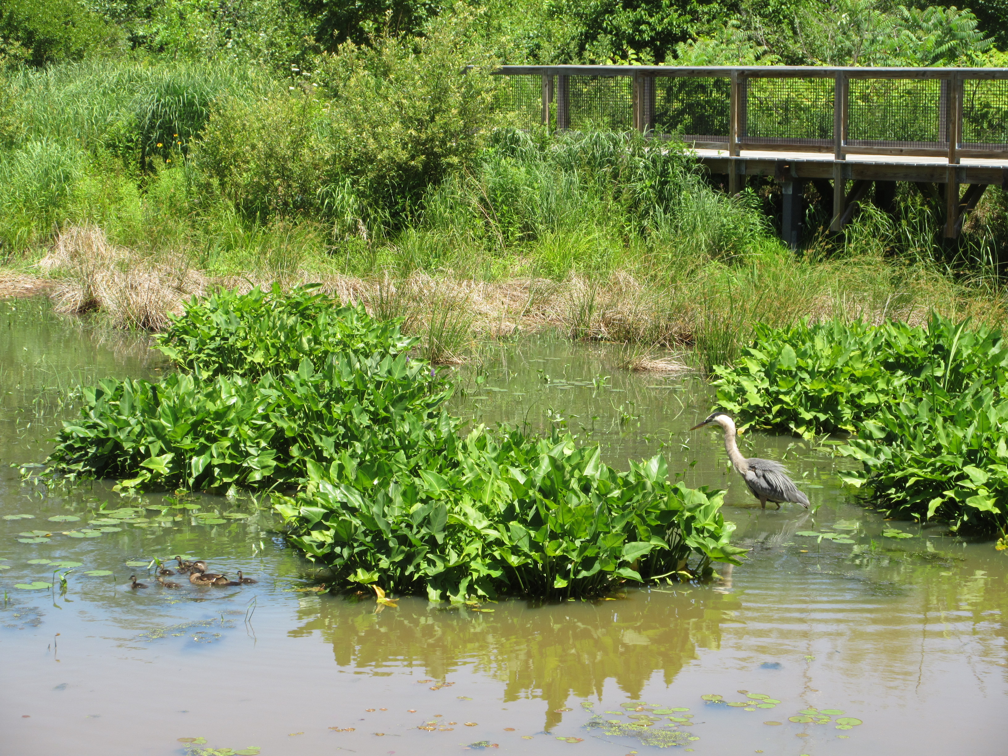
In 2001, to ensure that storm events in the future cause less devastation to property, the Conservation Fund and the Milwaukee Metropolitan Sewerage District (MMSD) launched a pioneering flood management program called Greenseams. Greenseams is an innovative flood management program that permanently protects wetlands and other lands containing water-absorbing soils by purchasing land and conservation easements from willing landowners in the Milwaukee, Menomonee, Oak Creek, and Root River watersheds, where major suburban growth is expected to occur in coming years. The properties that are purchased are chosen for their proximity to water, water-absorbing soils, environmental corridor, natural area designations, and connection to public spaces (CF 2016).
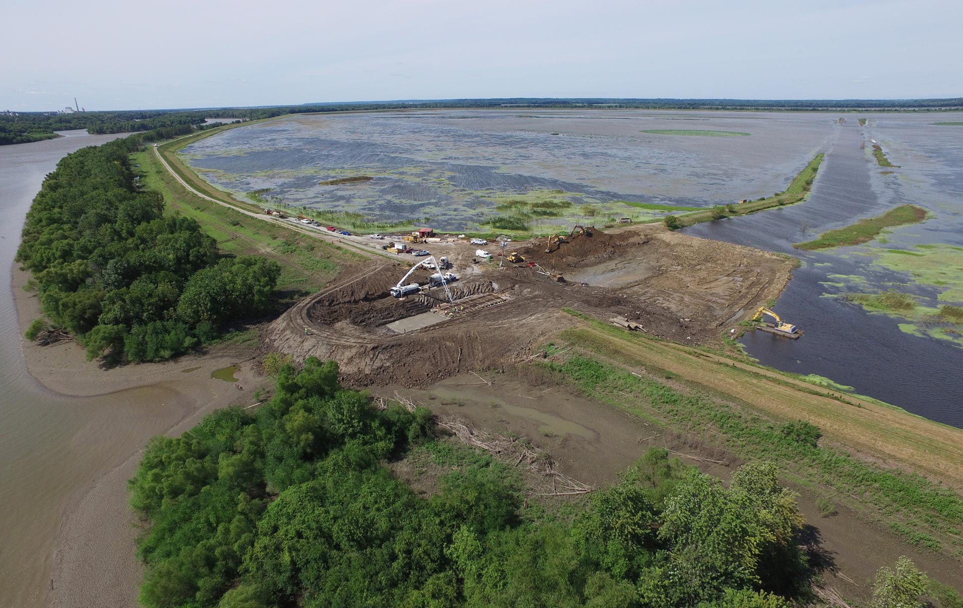
One of the more recent projects, the program’s 100th, was completed in partnership with Ozaukee Washington Land Trust (OWLT), where a 155-acre property in the City of Mequon was purchased for $1.2 million. On 85 acres of the property, Greenseams provided $200,000 toward a conservation easement, protecting important hydric soils, wetlands, surface drainage and wooded natural areas. Also, OWLT received a $600,000 grant from the Knowles-Nelson Stewardship Program, Wisconsin’s land conservation account. The remaining funds for the project came from several sources, including the Great Lakes Restoration Initiative, Greater Milwaukee Foundation, private donors, and the Milwaukee Audubon Society. With this funding, the remaining 70 acres of the property will undergo a restoration process over the next few years that will include prairie plantings, reforestation, wetland restoration, and trail development. The site will be open to the public for passive recreational enjoyment (CF 2016).
Since the program’s inception, 103 properties preserving 3,271 acres of flood-prone land that is capable of storing an estimated 1.3 billion gallons of water within greater Milwaukee have been protected, representing an area that includes 28 communities and over 1.1 million people. Additionally, the Greenseams program has planted 102,862 trees on 500 acres that were previously agricultural lands. And with all the Greenseams properties open to the public, residents and visitors are provided with the experience of being outdoors in natural settings, creating a sense of community and improving public health and happiness (CF 2016).
Funding/Financing
The Revolving Funds, a financing mechanism of The Conservation Fund, was established in 1986 and provides ready capital for acquisition of lands and waters of high conservation value. Funds are continually in use for conservation — upon repayment, the Conservation Fund “revolves” the money back into the Revolving Fund. Every dollar in the Revolving Fund is used to acquire property with no overhead and administrative expenses. Remaining funds for projects come from a variety of sources that include grants from foundations, private donors and wetland restoration initiatives (CF 2016b).
Benefits
The primary benefit of the Greenseams program is ecological. By protecting and restoring remaining wetlands through site acquisition, the region has reduced the amount of future flows and contaminants into receiving rivers, increasing water quality and improving wildlife habitat.
Additional benefits include increased social opportunities, public health and general flood protection. The social and public health benefits of the program include an increase of recreational opportunities (new trails for walking and hiking), improving the overall wellness of the community and visitors. The general flood protection benefit is obtained by the restoration of wetlands. By restoring wetlands to their natural settings, the chance of an extreme flood event decreases.
Sources
Wisconsin Wetlands Association (WWA). 2002. Wetland Communities of WI.
Wisconsin Department of Natural Resources (WDNR). 2006. Milwaukee River Basin Wetland Assessment Project. Developing Decision Support Tools for Effective Planning.
The Conservation Fund. 2016a. Greenseams Milwaukee.
The Conservation Fund. 2016b. Conservation Acquisition. Our Revolving Fund.