Houtrib Dike Pilot Project, Lelystad, Netherlands
Challenge: With increasing sea levels and more frequent storm surges, there is a growing need for adaptable solutions that can cope with climate change. In the Netherlands, where 26% of the country’s landmass lies below the mean sea level, more than 14,000km of dikes currently protect the coast but must be periodically monitored to guarantee they are still ‘fit for purpose’. If they are no longer able to maintain the necessary safety levels, actions are taken to protect people living on the coast and valuable infrastructure.
Project Details
- Location: Lelystad, Netherlands
- Population: 78,598 (in 2020)
- Strategies: Creation of a sandy foreshore
- Cost: (€) 4 million Euros (construction + 4y monitoring)
- Benefits: Scalability
Overview/History: The Houtrib Dike is a water defence system built to protect the area surrounding the Markermeer lake, an artificial freshwater lake created in 1972 by the construction of the Houtrib Dike. The reclaimed area from the sea was supposed to become agricultural land, but the initial plan was never concluded, while the site acquired ecological importance over time. Located at River Rhine’s catchment area, Markermeer and its neighbouring lake, IJsselmeer, became a single Natura 2000 boundary. The dike was assessed to be no longer meeting the flood safety criteria, thus a reinforcement or an alternative replacement was required. Thus, a pilot project was developed to assess the reinforcement of the dike with adjacent sand deposition instead of the traditional solution of enlarging the dike. The specific goal was to evaluate the potential of sandy reinforcements in lacustrine environments to mitigate flood risk under moderate wave conditions.
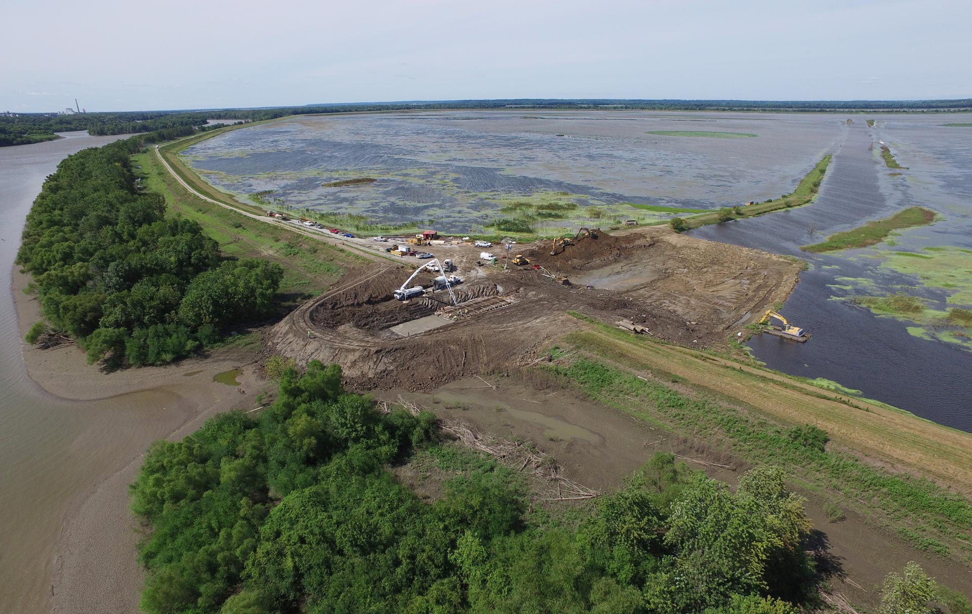
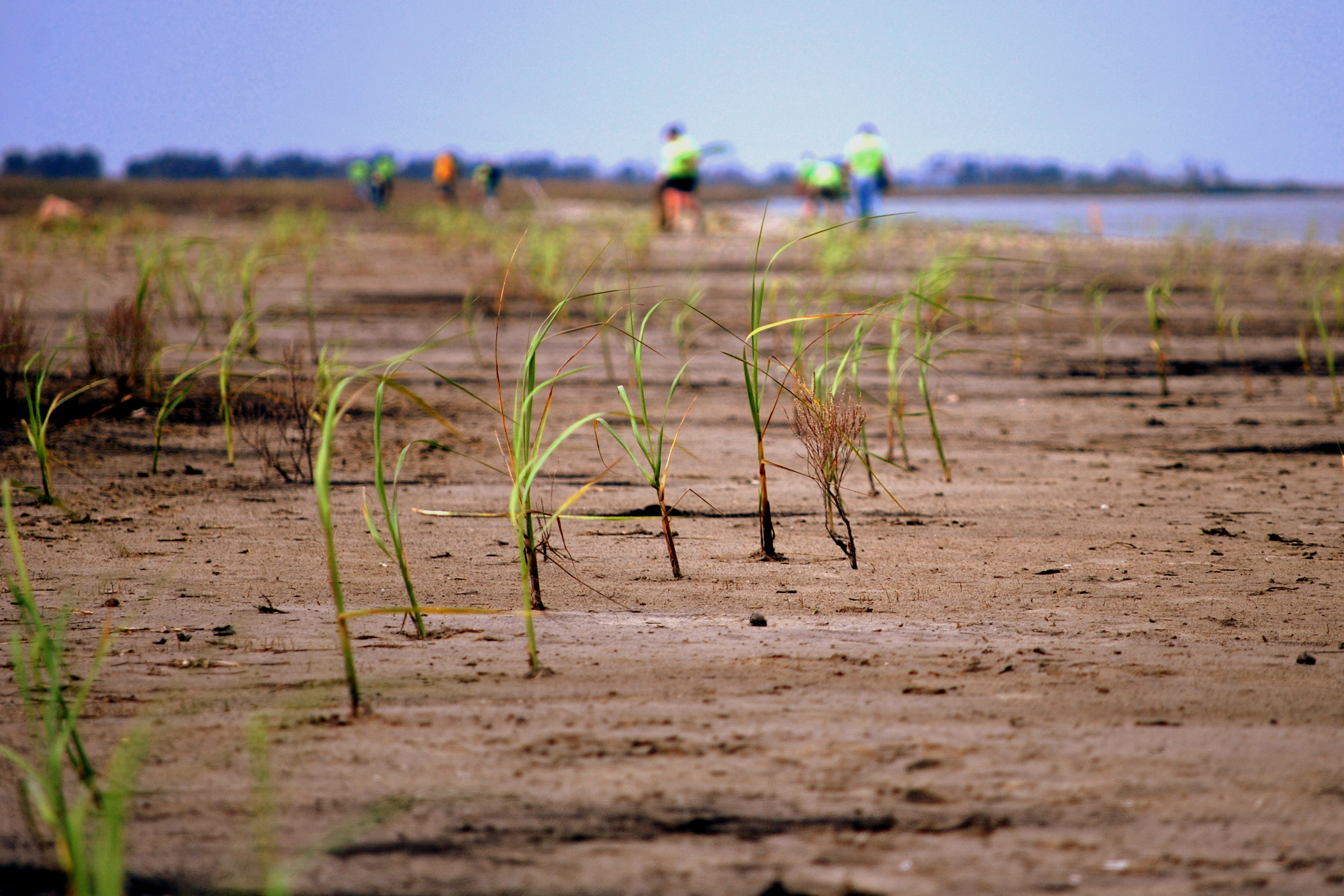
Solution: The opportunity to apply a NbS-approach through the construction of a sandy buffer instead of traditional dike reinforcement was a key element during the implementation phase. Approximately 70,000m³ of sand were deposited in a 400m long section of the Houtrib Dike as part of an innovative solution to naturally reinforce dikes instead of physically expanding the dike’s footprint. Additionally, native vegetation was planted in certain sections of the foreshore of the deposited sand berm to increase its stability.
After 4 years of monitoring through 23 individual surveys, the pilot was considered stable as the foreshore presented little sand loss besides some extreme events with waves above 1.2 m. The reeds planted in the lower section of the reinforcement did not resist the impact of waves above 0.2m, thus it was not possible to measure wave reduction resulting from vegetation presence; yet, mixing clay into the sand was shown to have a positive impact in the early stages of vegetation growth. The successful outcome of the pilot project supported the reinforcement of other sections of the Houtrib Dike and the lessons learned have subsequently been incorporated into the Dutch Flood Protection Program elsewhere.
Funding/Financing: The project cost approximately 4 million Euros, including construction and 4 years of monitoring to ensure its stability. The majority of the funding was provided by the Ministry of Infrastructure and Water (Rijkswaterstaat).
Benefits: The main benefit of the pilot project was to reduce flooding through continued stability of the dike using NbS. In addition, biodiversity enhancement is also considered a benefit as the planted vegetation thrived in the upper section of the sandy foreshore with additional vegetation naturally establishing in other areas. This pilot project was extremely important to support the development of a method for creating and maintaining sand berms and provided new insights about hybrid dikes (i.e., the combination of NbS with traditional hard engineering structures) and data requirements to validate models that simulate cross-shore developments of a sandy profile in a lake-environment.
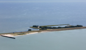
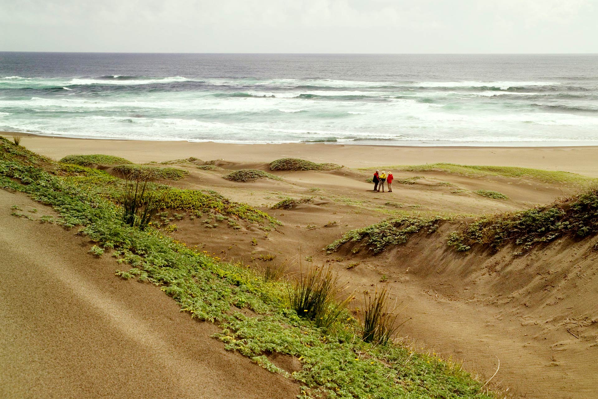
Houtrib Dike trial section in 2017. Source: https://www.ecoshape.org/app/uploads/sites/2/2016/07/Public-Summary-Houtrib-Dike-Sandy-Foreshore-Pilot-Project.pdf
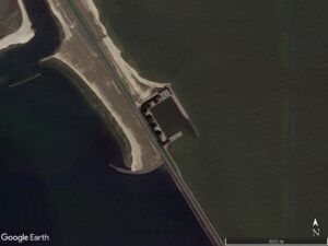
Houtrib Dike after reinforcement. Source: Google Earth.
References:
Population of Lelystad. Source: https://www.cbs.nl/en-gb/figures/detail/37259eng?q=Lelystad
Flood risk in the Netherlands. Source: https://www.pbl.nl/en/correction-wording-flood-risks#:~:text=This%20should%20have%20read%20that,is%20susceptible%20to%20river%20flooding.
Houtrib Dike Pilot Project. Source: https://www.ecoshape.org/en/pilots/hybrid-flood-defence-houtribdijk-sandy-foreshore-2/
Pilot with hybrid flood defence at Houtribdijk in the Netherlands. Source: https://www.ecoshape.org/app/uploads/sites/2/2016/07/Factsheet-Houtribdijk-EN.pdf
Houtrib Dike Sandy Foreshore Pilot Project – Public Summary. Source: https://www.ecoshape.org/app/uploads/sites/2/2016/07/Public-Summary-Houtrib-Dike-Sandy-Foreshore-Pilot-Project.pdf
FORESHORE PILOT PROJECT FOR HOUTRIB DIKE – General final report. Source: https://www.ecoshape.org/app/uploads/sites/2/2016/07/General-final-report-FORESHORE-PILOT-PROJECT-FOR-HOUTRIB-DIKE.pdf
Pilot Houtribdijk – Construction of a sandy foreshore. Source: https://www.wur.nl/en/research-results/research-funded-by-the-ministry-of-lnv/expertisegebieden/kennisonline/pilot-houtribdijk-construction-of-a-sandy-foreshore.htm
Ramsar Information Sheet – Markermeer & IJmeer. Source: https://rsis.ramsar.org/RISapp/files/RISrep/NL1245RIS_1701_en.pdf
Map indicating the boundaries of Markermeer and IJsselmeer. Source: https://rsis.ramsar.org/RISapp/files/4245458/documents/NL1245_lit161107.pdf