Salt Marsh Restoration in Lippenbroek, Lippenbroek, Belgium
Challenge: The low-lying coast of Belgium has historically been at risk from flooding. Extensive engineered grey infrastructure solutions have been implemented to mitigate risk, but with an increasing frequency of extreme sea levels, this infrastructure has repeatedly been overrun. In 1953, a devastating storm hit the coast of Belgium (Vlaanderen), taking hundreds of lives, and producing large economic costs. In 1976, a massive storm struck the Belgian coast and caused the Scheldt River to over top its banks and flood more than 800 ha and around 900 houses. These major events combined with the expected increase in flood risk during the 21st century made clear that a flood risk management strategy was needed to guarantee the safety of the population and to mitigate the impacts of flooding on economic development.
Project Details
- Location: Lippenbroek, Belgium
- Population: 24,220
- Strategies: Ecosystem restoration (salt marshes)
- Cost: Not informed
- Benefits: Flood reduction, Biodiversity enhancement
Overview/History: The Lippenbroek region located along the river Scheldt in Hamme, Belgium, was mostly agricultural land reclaimed from the sea through dikes. The Lippenbroek was a small polder of approximately 10 ha that became a flood control area in 2006 as part of the Sigma Plan. The site was used as a pilot project by the Belgian authorities to test the usage of Controlled Reduced Tide (CRT) schemes for flood control and habitat creation. The learnings of this work are intended for replication purposes in other sections of the Belgian coast and estuarine areas.
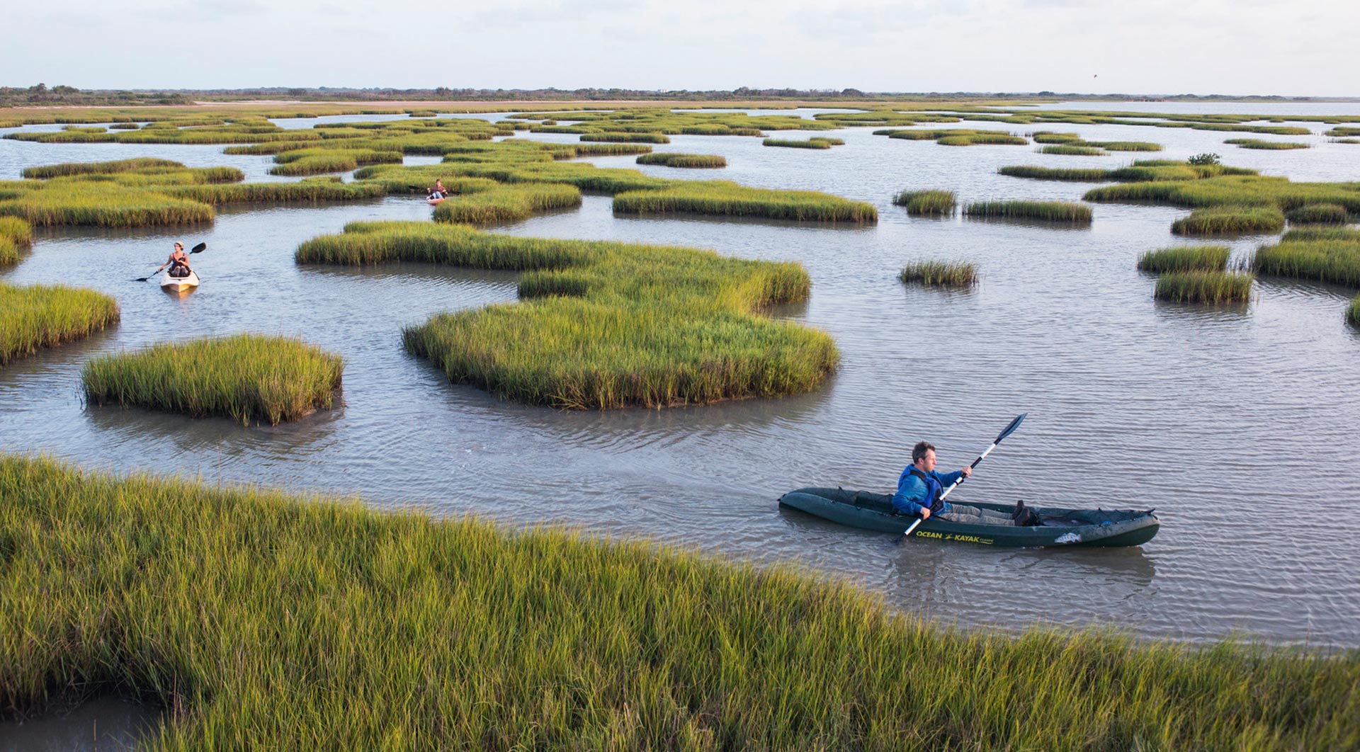
Solution: Lippenbroek’ CRT scheme has two main components: a high inlet sluice and a low gravity-controlled outfall sluice. The mechanism creates a flood control area for the Scheldt River when the water level rises during storms, while the gravity-controlled outfall allows the water levels to decrease after the storm. Although the scheme has not affected the pattern of spring and neap tides (i.e., the duration and amplitude of tides according to the moon phase), the shape of the tidal curve has been distorted by the artificial tidal regulation (high inlet and low outlet), which creates a stagnant high-water phase during 1 to 2 hours, allowing marsh habitats to develop in 80% of the site only three years after implementation. The remaining 20% of the site has turned into an intertidal flat habitat with shallow waters (creeks and channels).
Funding/Financing: The project was funded by the ANB (the Flemish Nature and Forestry Agency), which are the owners of the Lippenbroek. However, there is no cost information available at this point. To secure a comprehensive monitoring program, additional resources were employed by the Flemish Agency for Waterways and the Brussels-Scheldt Sea Canal. Monitoring and research are led by the University of Antwerp as part of the OMES framework, a multidisciplinary research program on the results of the Sigma plan in the Belgian portion of the Scheldt estuary.
Benefits: Lippenbroek successfully achieved its purpose acting as a flood water storage. The extensive monitoring of the projects implemented by the Sigma Plan has also indicated that oxygen levels have increased, and fish species have been observed in the estuary and in the flooded area. Reeds, willows, and typical wetland plant species are now occupying around 80% of the site, which also became a feeding and nesting site for waterfowl.
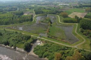
Aerial view of Lippenbroek. Source: https://www.tide-toolbox.eu/measures/lippenbroek/description_of_measure/
References:
Onderzoek naar de gevolgen van het Sigmaplan, baggeractiviteiten en havenuitbreiding in de Zeeschelde op het milieu (in Dutch). Source: http://www.omes-monitoring.be/nl/OMESreport2015
Lippenbroek. Source: https://www.sigmaplan.be/en/projects/lippenbroek/project/
Project map. Source: https://www.sigmaplan.be/en/projects/lippenbroek/
Saltmarsh restoration by a controlled, reduced tide at Hamme, Lippenbroek – BE. Source: https://discomap.eea.europa.eu/map/Data/Milieu/OURCOAST_008_BE/OURCOAST_008_BE_Case_Hamme_Lippenbroek.pdf
Case Study on the Lippenbroek Regulated Tidal Exchange Scheme (Belgium). Source: https://restorerivers.eu/wiki/images/5/59/Lippenbroek_Regulated_Tidal_Exchange_Scheme.pdf
Case study: Lippenbroek Regulated Tidal Exchange Scheme. Source: https://restorerivers.eu/wiki/index.php?title=Case_study%3ALippenbroek_Regulated_Tidal_Exchange_Scheme
Definition of Polder. Source: https://dictionary.cambridge.org/dictionary/english/polder
Population of Hamme. Source: https://www.citypopulation.de/en/belgium/census/oost_vlaanderen/42008__hamme/
Lippenbroek: Flood Control Area with Controlled Reduced Tide (FCA-CRT). Source: https://www.tide-toolbox.eu/measures/lippenbroek/monitoring_results/
Flood Risk Management in Flanders: Past Developments and Future Challenges. Source: https://core.ac.uk/download/pdf/55849625.pdf